30 best places to visit in the South Island (local’s guide)
This post includes some affiliate links and I earn a small commission if you book through them. This helps keep this site running and lets me keep writing ultra-detailed travel guides that are free for you to use to plan your next adventure. Read more in my privacy policy.
There are destinations that are nice for a week away, and then there are places that’ll completely ruin you for everywhere else. New Zealand’s magical South Island (Te Waipounamu) is firmly in the second category, and I say that as a Kiwi who’s explored almost every corner of it.
But I have to warn you, scrolling through South Island travel inspo is a slippery slope.
One minute you’re just checking flights to get an idea of prices, the next you’ve got 45 tabs open, all the best pie shops saved and a half-drafted resignation letter because you’ve realised you literally need to quit your job to see everything on your list.
Before you hit send on that email, let’s just dial it back a bit. While I fully support quitting your job to travel (obviously!), you don’t have to see every single pin on the map for your trip to be an absolute masterpiece, you just need to find the ones that actually fit your vibe.
And if you’re not quite sure what those are yet, I’ve got you! This comprehensive list of the best places to visit in the South Island is going to give you the rundown on every major spot, so you can divide them into ‘HELL YES’, ‘if we have time’ and ‘not my thing’.
Think of this guide as your definitive cheat sheet to the best places to visit in the South Island. It highlights every place that’s genuinely worth your attention, tells you exactly why you should visit, and points you to the deeper guides when you’re ready to start planning properly.
It’s not a plug-and-play ready-to-follow itinerary (but my ultimate South Island road trip is!), it’s not a subjective list of only my personal favourites, it’s a list of literally every place on the island that’s worth considering when you’re planning your first South Island trip.
Are you ready to discover your new favourite place? Here are the 30 BEST Te Waipounamu destinations you need to know about.
Quick summary: Best places to visit in the South Island
Short on time? Here’s a quick snapshot of the best South Island highlights broken down by travel style. Click the links to jump straight to that section of the guide.
- Best for first-timers (the icons): Queenstown, Milford Sound, Aoraki / Mount Cook, Lake Tekapo, Wānaka
- Best for wildlife: Kaikōura, Dunedin & Otago Peninsula, Stewart Island
- Best scenic drives: Lindis Pass, Haast Pass, Arthur’s Pass, Glenorchy, Milford Road
- Best value for money: Hokitika, Waitaki Valley & Ōamaru, Hanmer Springs (shoulder seasons) and the very Top of the South (outside of summer)
- Best for adventure: Queenstown (bungy & jetboats), Glacier Country (heli-hikes), Abel Tasman (kayaking & canyoning)
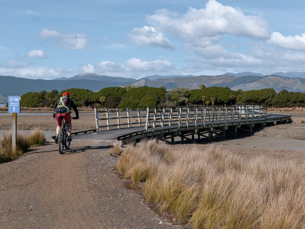
- Best for food & wine: Marlborough, Waipara Valley, Nelson, Christchurch, Queenstown
- Best for off-the-beaten-track: Upper West Coast, Doubtful Sound, the Catlins, Golden Bay
- Best for day walks: Aoraki / Mount Cook, Wānaka, Abel Tasman, Marlborough Sounds

Map of the best places in the South Island
To help you get your bearings, I’ve plotted every place in this guide onto the map below.
I’ve colour-coded the markers to align with the sections of this blog so you can easily see what fits together.
How to use this map: Click the star next to the title below and it’ll automatically save it to your Google Maps account! If you’re on a phone and can’t see the star then hit the full-screen icon in the map’s top-right corner to open it in a new tab and the star should come up.
To find it later: Open Google Maps and head to the ‘Saved’ (desktop) or ‘You’ (app) tab with the bookmark icon, find the ‘Maps’ tab, and select this guide. This overlays this map’s pins onto your own Google Maps, allowing you to tap into each one and save your favourites to build a rough route. Too easy!
The top 5 iconic places to visit in the South Island
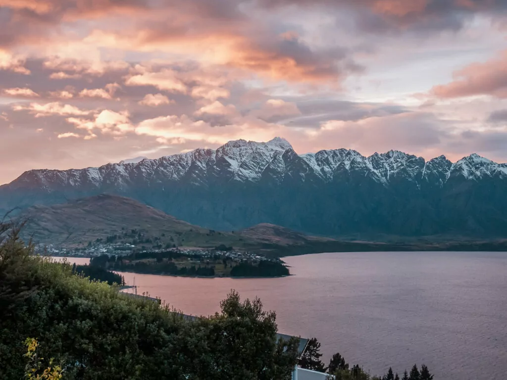
1. Queenstown
Location: In the Otago region, in the southwest of the South Island
Queenstown is the high energy capital of New Zealand, buzzing year-round with domestic and international visitors alike looking to tick this mountain-surrounded hotspot off their travel wishlist.
Small in size but overflowing with activities, Queenstown’s a choose-your-own-adventure kind of destination. Enjoy flat whites with brunch or indulge in fine dining with local wine, hit the hiking trails in summer or shred pinch-me powder in winter, spike your heartrate with a skydive or embrace your inner zen at a lakeside sauna or panoramic hot pools.
What Queenstown is known for
- A rare setup where mountains, lakes, ski fields, wineries, hiking trails, nightlife, luxury hotels and fine dining all exist in one compact, car-optional base
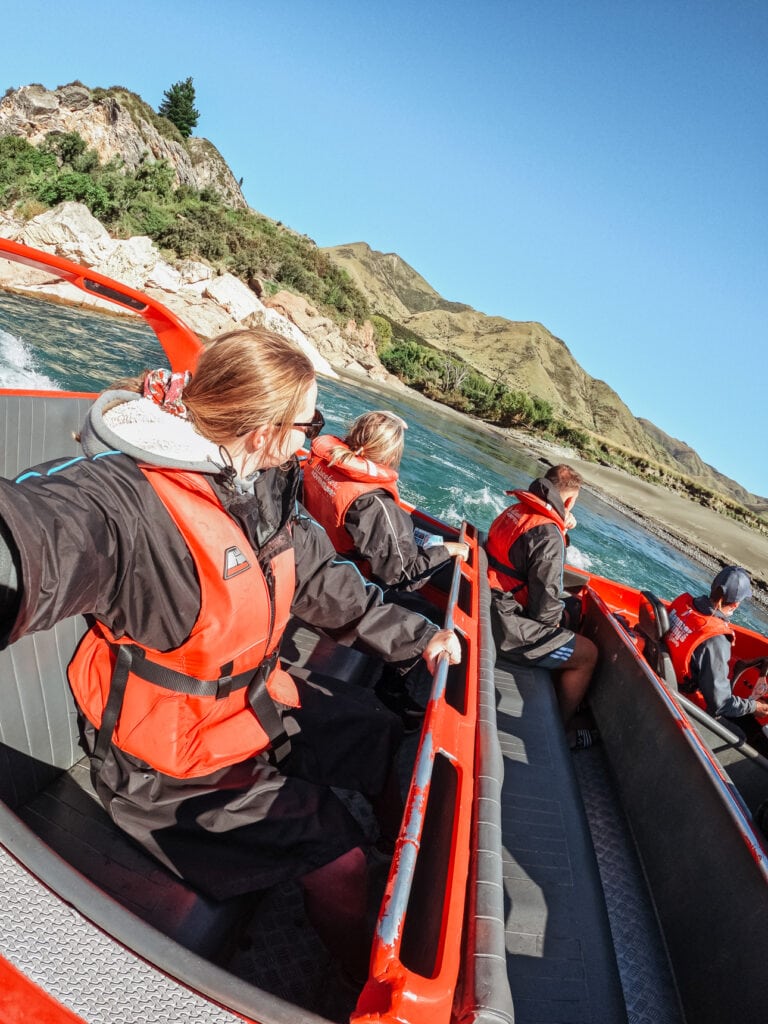
- The highest concentration of adrenaline activities anywhere in New Zealand, from bungy jumping to skydiving to jetboating
- A growing line up of hot pools, lakeside saunas and spa experiences for post-adventure recovery
- Being a convenient base for day trips to Glenorchy, Milford Sound, even Aoraki/Mount Cook if you’re short on time
➡️ Read more: If you want to go deep on activities, seasons, and how to maximise your time and money here, my dedicated 5‑day Queenstown itinerary will be your best friend.

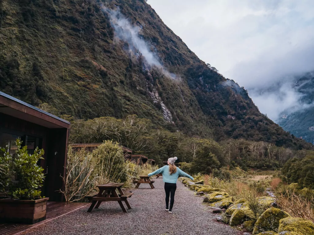
2. Milford Sound / Piopiotahi
Location: Fiordland National Park, about 2 hours from Te Anau and 4+ hours from Queenstown without stops
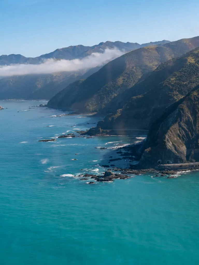
The undisputed champion of New Zealand landscapes, Milford Sound is carved by ancient glaciers, surrounded by near-vertical cliffs that shoot straight out of the water and fed by hundreds of waterfalls that tumble down the rock faces after rain.
It’s the most accessible of Fiordland National Park’s incorrectly-named ‘Sounds’ (it’s actually a fiord, and yes they spell it that way here), playing host to thousands of daytrippers daily, plus a much smaller cohort of lucky overnighters who get to experience it once the crowds have departed.
No words or photos will ever do this place justice, you really have to see it for yourself.

What Milford Sound is known for
- The epic drive along the Milford Road, with mirror lakes, valley lookouts and cheeky kea (alpine parrots) to spot along the way
- Insanely dramatic landscapes that look magical in all weather conditions
- Being the most accessible part of Fiordland National Park, doable with a day trip from Queenstown or Te Anau if you’re pressed for time
- Extremely high annual rainfall (typically 6-7m, and that’s not a typo!) which triggers an infinite number of temporary waterfalls
- Opportunities to spot wildlife like dolphins, kekeno (NZ fur seals) and tawaki (Fiordland penguins)
- Overnight cruises and the magical Milford Sound Lodge for the rare opportunity to experience Milford Sound without the tour buses
➡️ Read more: Check out my guide to the best things to do in Milford Sound for more ideas and links to the exact experiences I recommend.
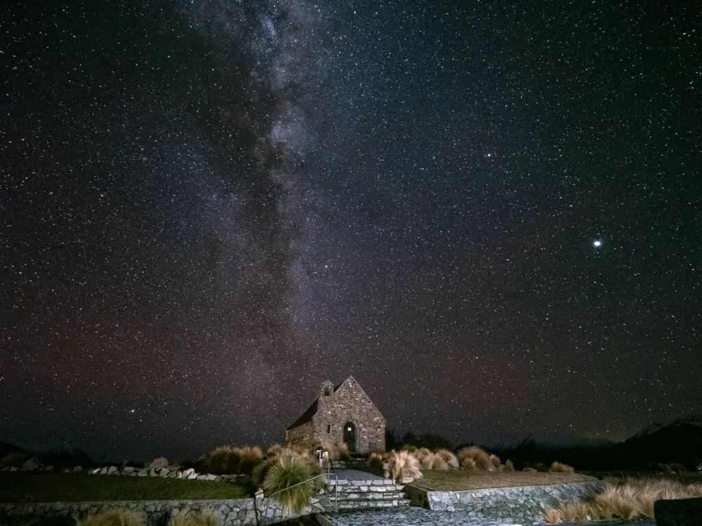
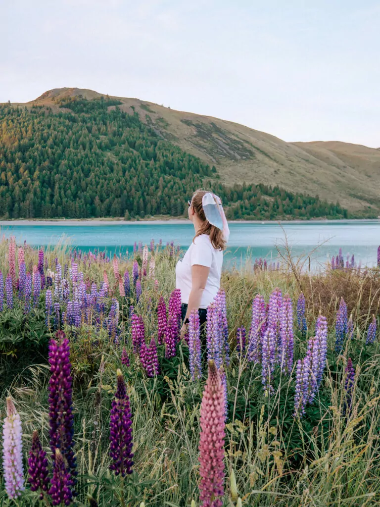
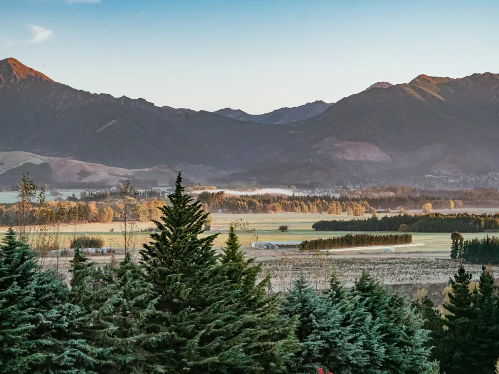
3. Lake Tekapo (Takapō) & the Mackenzie lakes
Location: In the Mackenzie district, roughly half way between Christchurch and Queenstown (about 3h from both)
If you’ve seen photos of South Island lakes where it looks like the saturation slider was pushed up to +100, they were probably taken here. And yes, they actually look like this in real life 🤯 it’s sorcery!
The Mackenzie Basin is a wide open, tussock-covered plateau that contains some of the most visually striking landscapes in the South Island.
Lake Tekapo (Takapō) is the region’s postcard icon, famous for its milky blue water and stone church on the lakefront. Nearby Lake Pukaki is even bluer and gives you a front row carpark view of Aoraki on the horizon. Twizel is more low key and functional, with holiday homes that can be more budget-friendly than Tekapo’s hotels, especially for families and groups.
What Tekapo & the Mackenzie is known for
- Unreal scenery with impossibly blue glacial lakes and intricate braided rivers, plus loads of viewpoints right off the highway
- Being one of the best places in the world for stargazing, the skies here are so clear they’re literally protected by law (as part of the Aoraki Mackenzie International Dark Sky Reserve)
- The famous Church of the Good Shepherd, one of the most photographed buildings in New Zealand
- All-weather experiences like hot pools and 4WD off-roading adventures
- A short but sweet summer lupin season (late Nov to early Jan) where the lakefront and roadsides come alive with pink and purple flowers
➡️ Read more: My deep-dive on the best things to do in Tekapo includes epic things to do, accommodation for all budgets and helpful tips to maximise money & time.
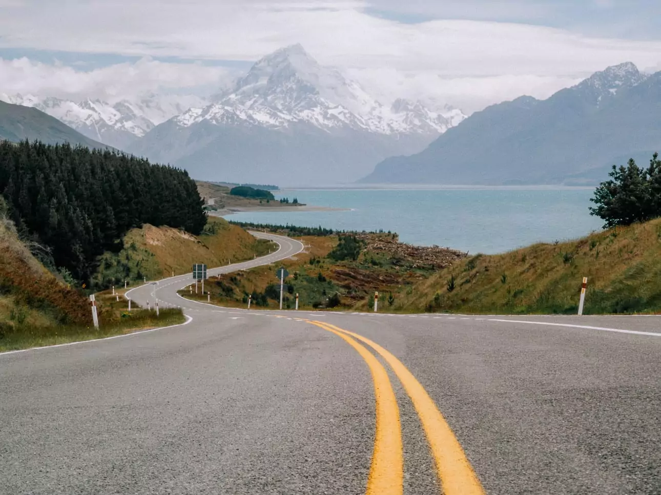
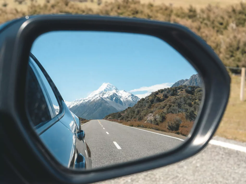
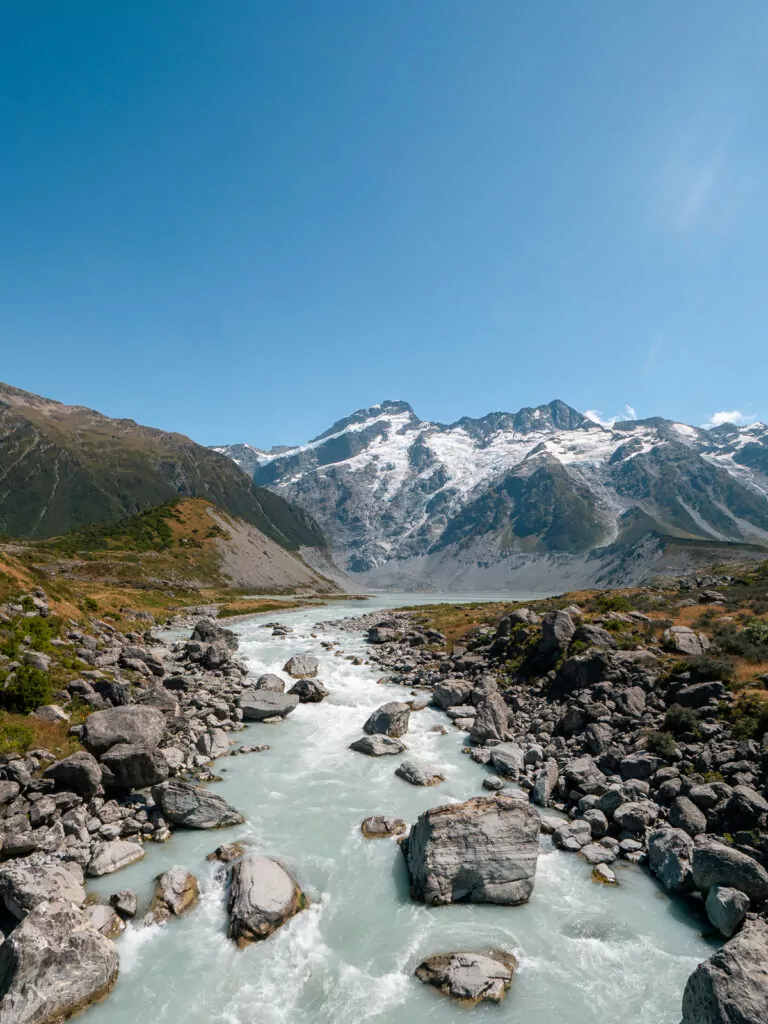
4. Aoraki / Mount Cook National Park
Location: In the Mackenzie district, about 1h 15m from Tekapo, 3h 15m from Queenstown and just over 4h from Christchurch
The mighty Aoraki / Mount Cook is the poster child of the Southern Alps, and the alpine village below it acts as a basecamp for hikers and sightseers hoping for clear skies to witness Aotearoa’s highest peak up close.
What Aoraki / Mount Cook NP is known for
- A super scenic drive that leads you along Lake Pukaki’s neon-blue water and directly towards New Zealand’s highest mountain (3724m/12,281ft)
- Some of the South Island’s most rewarding day hikes, with routes for all fitness levels and knockout views around every corner
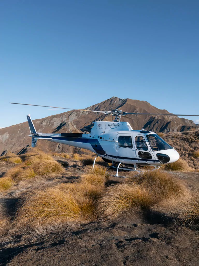
- Tasman Glacier, the country’s largest and longest, which can be experienced via a glacier lake cruise, scenic flight or heli-hike
- World-class stargazing as part of the Aoraki Mackenzie Dark Sky Reserve
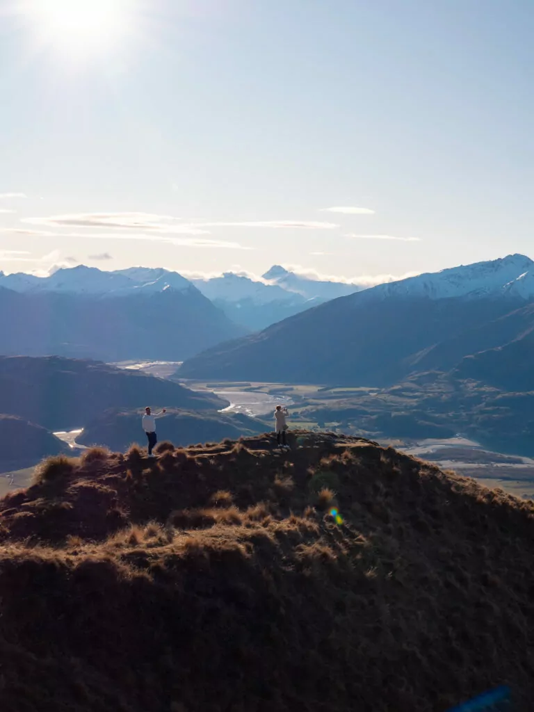
5. Wānaka
Location: Otago region, just over an hour’s drive from Queenstown
If Queenstown is the overachieving eldest daughter trying to do it all, Wānaka is the effortlessly cool younger sibling who’s got a much healthier work-life balance 🙃
It used to be seen as a quiet alternative to the adventure capital on the other side of the Crown Range, but Wānaka has firmly established itself as a destination in its own right, especially for hikers, skiers and slower-paced travellers looking for quintessential alpine scenery without the frantic energy of mass tourism.
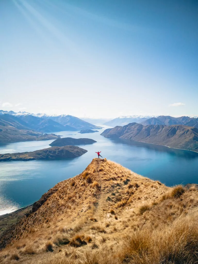
What Wānaka is known for
- The same kind of mountains-and-lakes backdrop as Queenstown but with a slower pace and more local vibe
- The famous Roys Peak ridgeline photo spot accessible via hike (but there’s a secret way to skip the physical exertion if you’re short on time 🤫)
- Boutique shops, casual eateries and food trucks
- Being an easy base for Treble Cone and Cardrona ski fields
- Probably the most photographed tree in New Zealand
➡️ Read more: Check out my full guide on the best things to do in Wānaka to help plan your stay.
Queenstown/Fiordland side quests
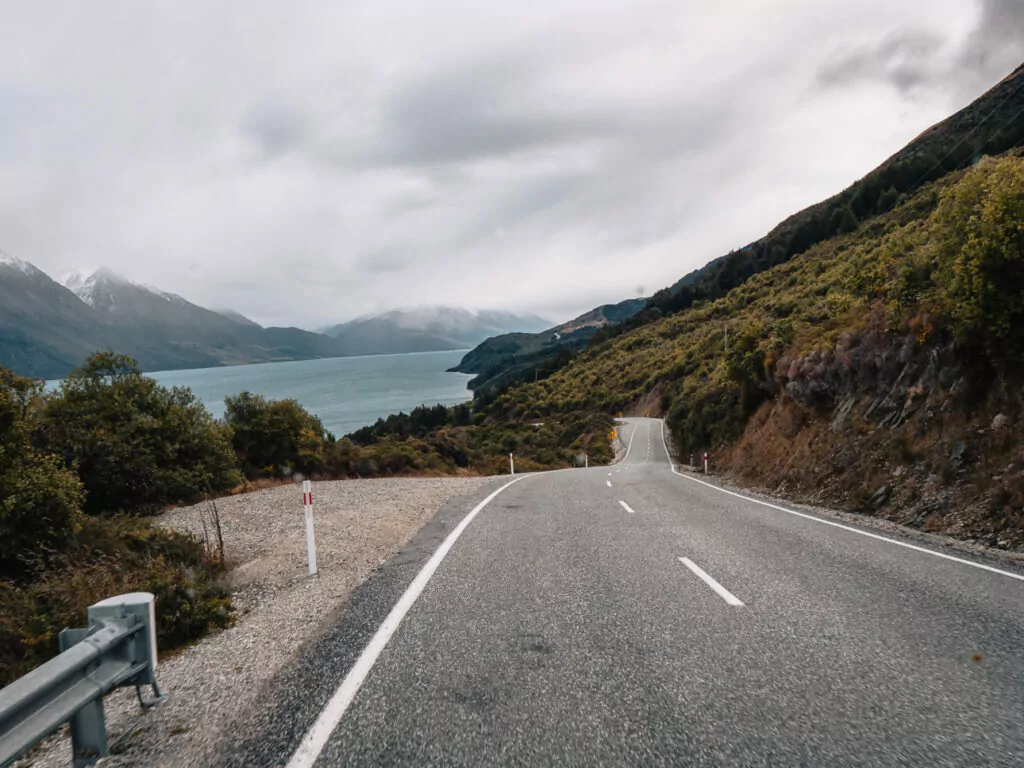
6. Glenorchy
Location: Otago region, 45 mins west of Queenstown
This little settlement at the end of Lake Wakatipu is one of the most popular day trips from Queenstown, but if you’ve got more time to spare, you’ll discover there’s much more to Glenorchy than the journey to get there and a famous red shed.
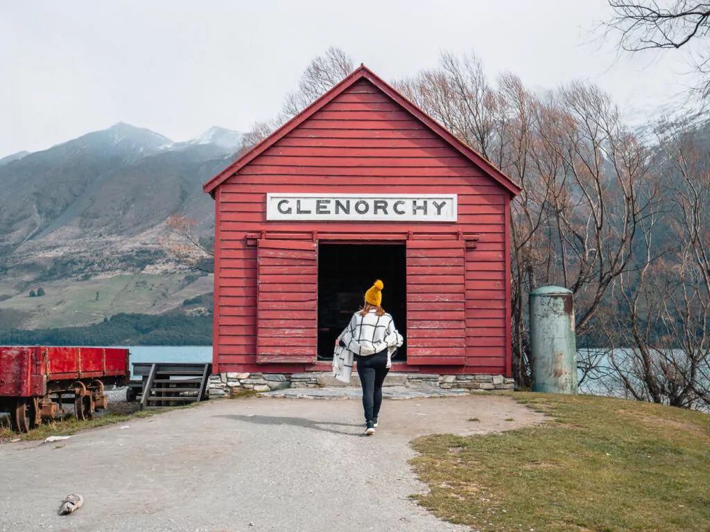
What Glenorchy is known for
- A drive so scenic you’ll want to pull over every five minutes
- Filming locations from Lord of the Rings as well as other cinematic sensations, with top-rated tours for the fans who want the full experience (complete with costumes!)
- Backcountry hikes and campsites for intrepid travellers
- Being the gateway to the epic Routeburn Track (2-4 days) as well as day adventures like jetboating, funyaking and ziplining
7. Te Anau
Location: Fiordland, about 2h from Queenstown
Every remote national park needs a trusty basecamp and Te Anau plays that role perfectly.
It’s not trying to be a headline act (good luck beating the drama of Milford Sound or the serenity of Doubtful Sound), it’s the ultimate Fiordland gateway and logistical hub where you load up on snacks before going bush and have the best sleep of your life when you return to civilisation.
But don’t just treat it as a crash pad, there’s plenty of fun stuff right here on the lakefront to keep you entertained.
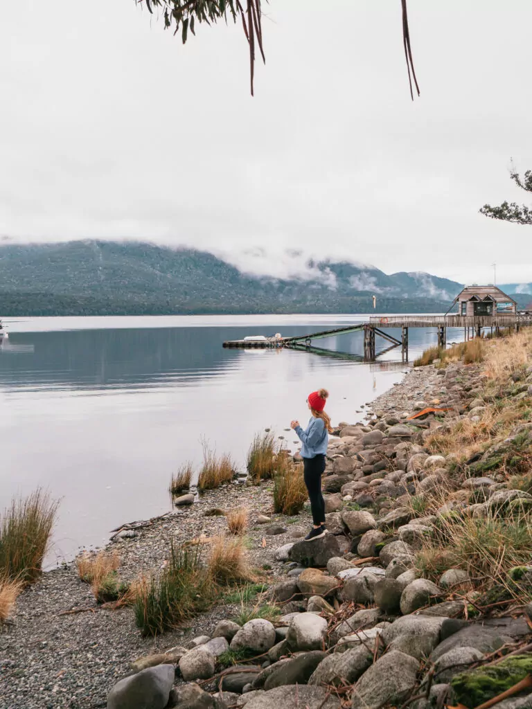
What Te Anau is known for
- Being the springboard to all things Fiordland, from Milford and Doubtful Sound cruises to the Kepler Track and other outdoor adventures
- Its lakefront location on the South Island’s largest lake, which perfectly reflects the mountains on a calm day
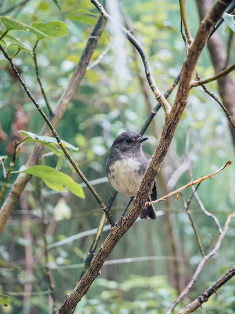
- The rare takahē, a bird once thought extinct, now living at a sanctuary right in town
- A surprisingly impressive food scene for a town this small and this remote
- Ata Whenua – Shadowland, a 30 minute cinematic masterpiece about the National Park exclusive to Fiordland Cinema right in the centre of Te Anau
➡️ Read more: Use my guide on the best things to do in Te Anau to plan the perfect stay here.
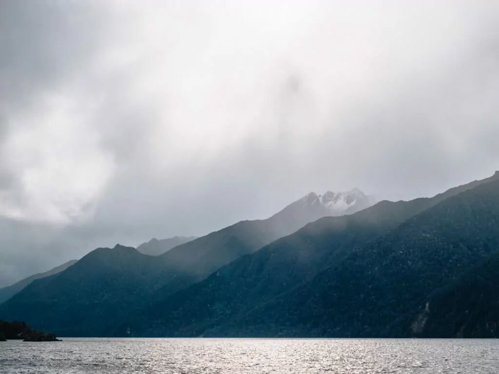
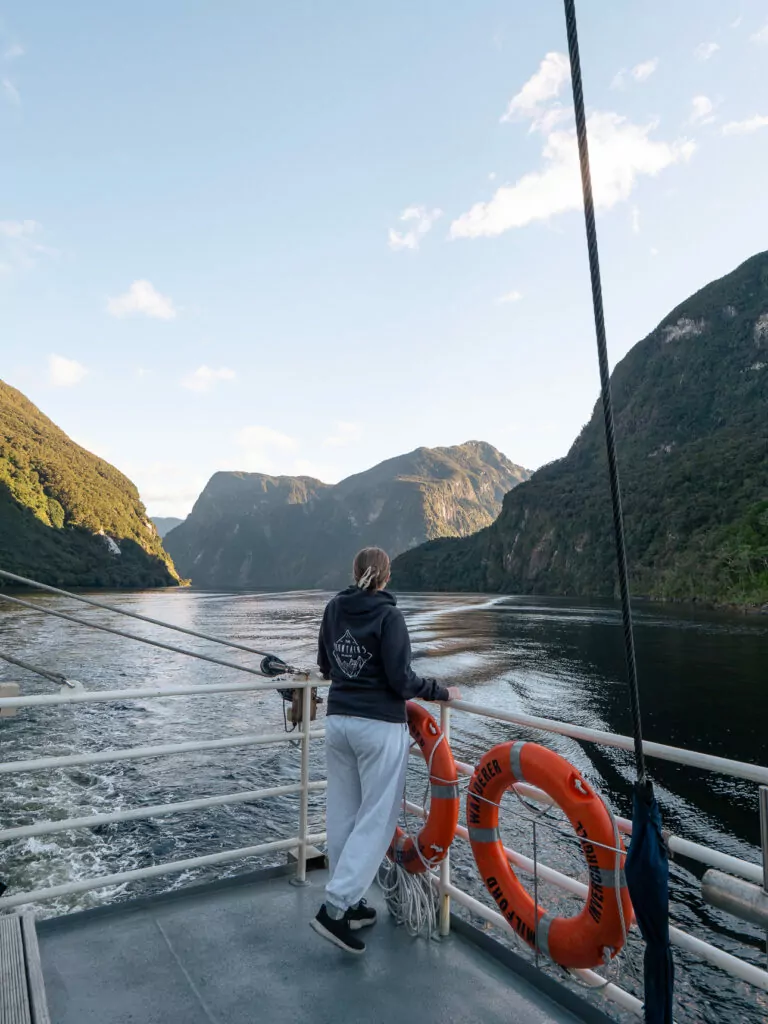
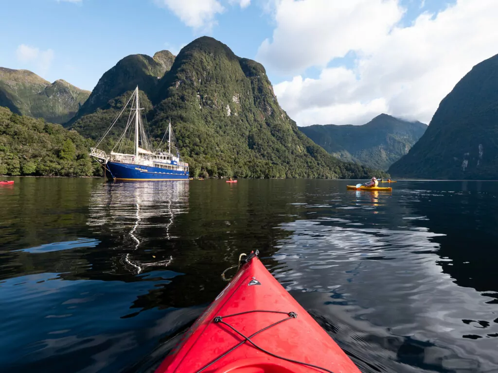
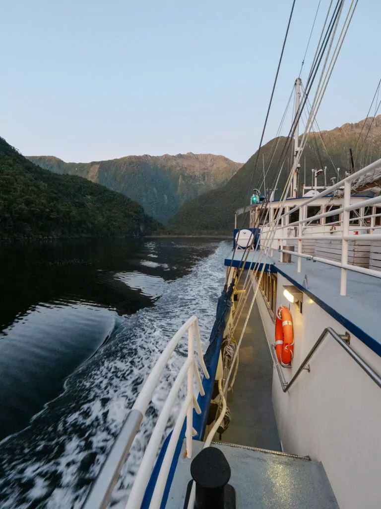
8. Doubtful Sound / Patea
Location: In Fiordland National Park, accessible by a boat-bus-boat combo from Lake Manapouri which is a 20 min drive from Te Anau
A stark contrast to the steady stream of boats that sail through Milford Sound all day, Doubtful Sound / Patea feels almost entirely disconnected from the modern world.
That’s all thanks to the mission it takes to get there: a cruise across Lake Manapouri, a bus over the Wilmot Pass to reach your vessel, then the journey deep into the fiord itself. You miiiight come across one other tourist ship and the odd boatie heading out for a fish or a dive, but when the captain turns the engine off and tells everyone to stop talking, you’ll experience a literal moment of silence for maybe the first time in your life. Soul-stirring.
It’s true that Doubtful Sound’s scenery is more gentle and rolling than Milford’s jagged peaks, but for travellers who prefer solitude over spectacle, it’s the clear winner.
What Doubtful Sound is known for
- Pristine, untouched fiord scenery that takes real effort to reach but is absolutely worth it (7h from Manapouri, 8.5h from Te Anau or 13h from Queenstown)
- A resident pod of bottlenose dolphins
- Far fewer boats on the water than Milford
- Overnight cruises that give you the only opportunity to kayak, swim and sip wine under the stars in one of the most secluded spots in the country
➡️ Read more: Can’t decide between the two icons? Read my detailed comparison of Milford Sound vs Doubtful Sound to help you choose.
The wild West Coast: Glaciers, pounamu & Pancake Rocks
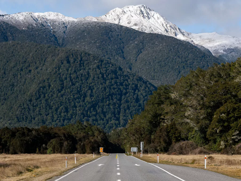
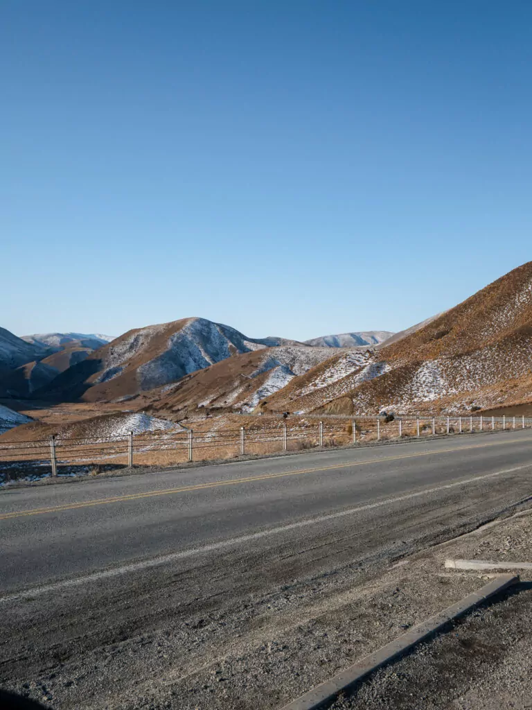
9. Haast Pass
Location: Connecting Wānaka to the West Coast via SH6
Bridging the golden valleys and shimmering lakes of Central Otago with the prehistoric rainforest and wild beaches of the West Coast, the 140km Haast Pass is another bucket list journey for your South Island road trip.
What the Haast Pass is known for
- Inaccurate Google Maps drive times, because there’s so many places you’ll want to stop along the way!
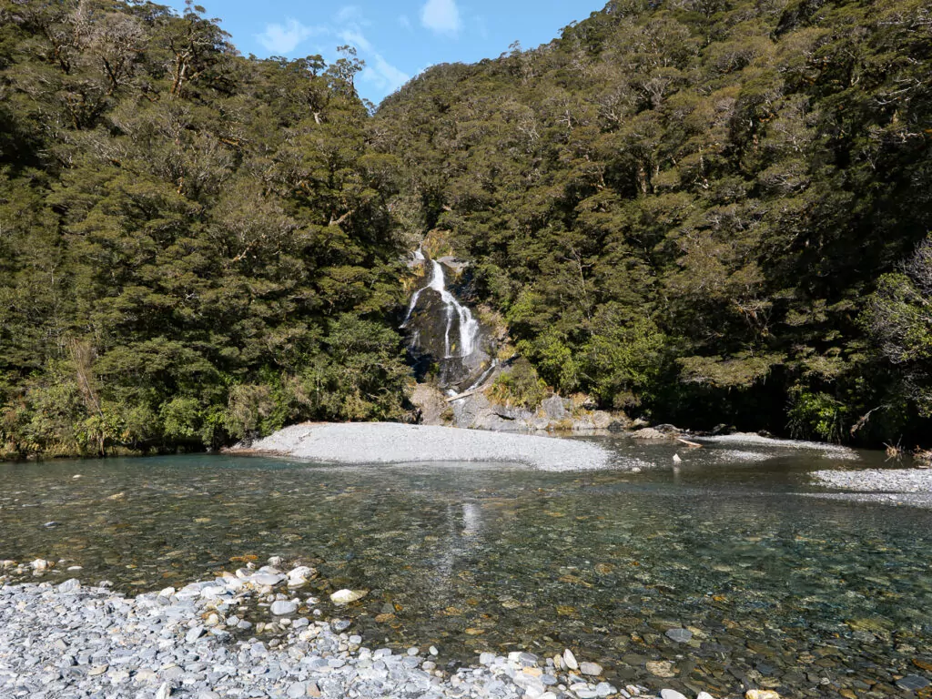
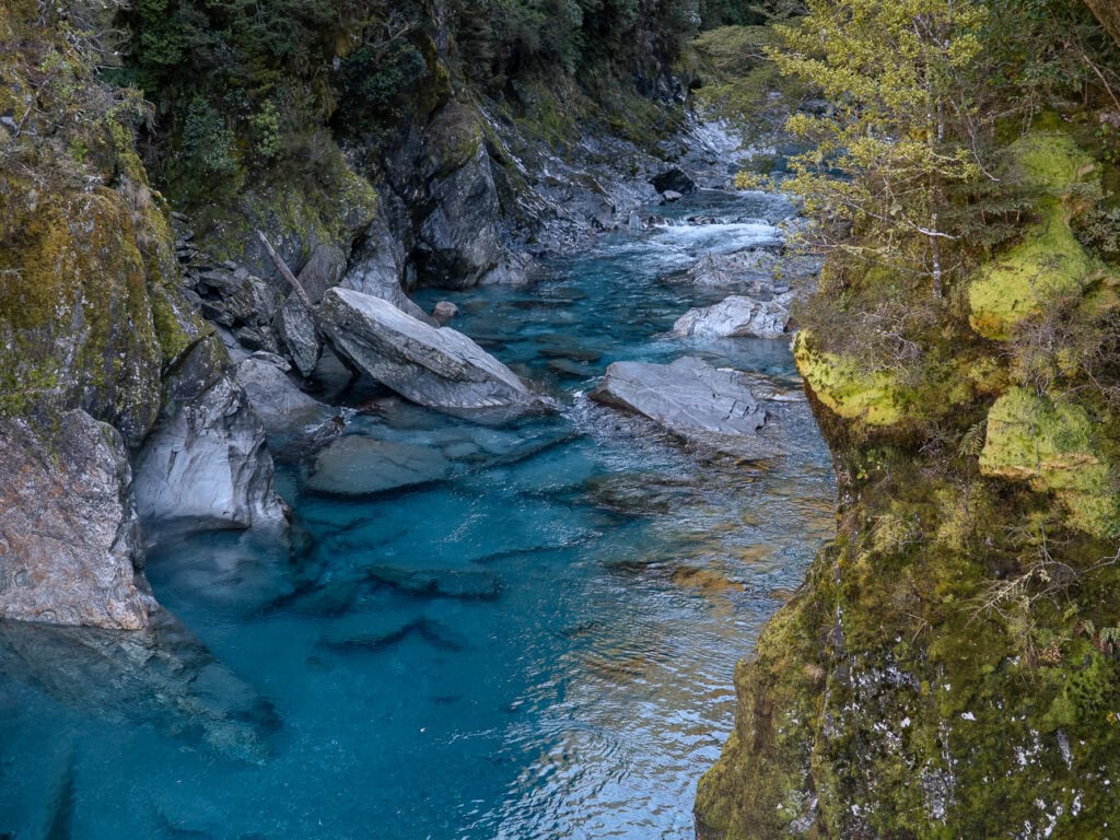
- Short walks to waterfalls and swimming holes scattered along the highway, including the must-see Blue Pools
- Crystal-clear glacial rivers where you can literally see shadows of the fish on the riverbed
- Having minimal infrastructure from Lake Hawea until you reach Haast right on the coast, top up on fuel in Wānaka (West Coast petrol prices are wild) and grab picnic supplies before you hit the road
- Sandflies 🫠
➡️ Read more: Planning to drive the Haast Pass and beyond? Check out my West Coast road trip itinerary for the best stops from Wānaka to Glacier Country (and the rest of the coast!).
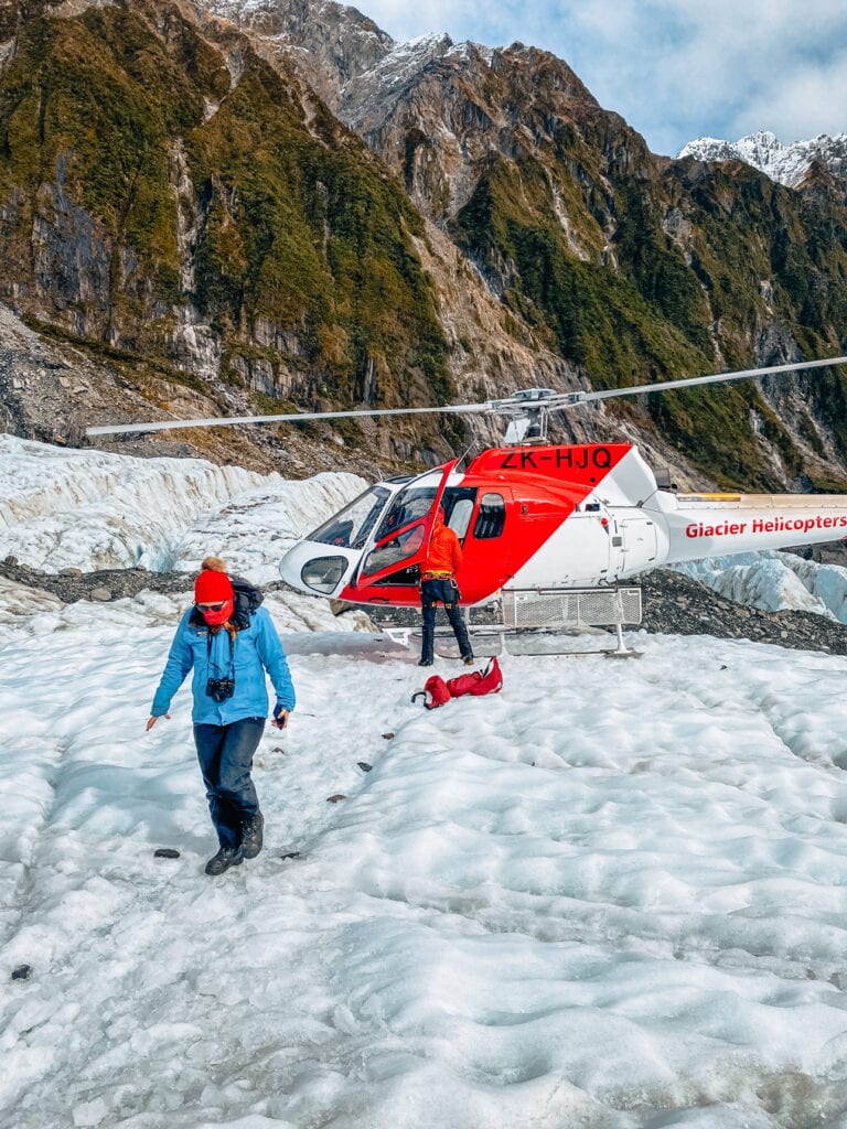
10. Glacier Country (Franz Josef / Waiau & Fox Glacier)
Location: The lower West Coast, 3h 30m-4h from Wānaka
One of the few places on the planet where ancient glaciers meet thick rainforest, in Glacier Country you can experience Jurassic Park and the Ice Age all in the same day. Wild!
Franz Josef / Waiau and Fox Glacier are the main hubs for all adventures, from bucket list heli-hikes to chilled out kayaking trips and hot pools to thaw out after a day in the mountains.
What Glacier Country is known for
- A glacier + rainforest + beaches combo that’s ultra rare and almost never this accessible
- Helicopter flights to ancient icy terrain for glacier photo stops, hikes, climbing and even overnight camping!
- Quick-changing weather that you really can’t plan ahead for, so it’s best to stay a couple of nights to give yourself buffer time in case of activity disruptions
- Rainy day adventures like quad biking, kayaking, private hot tubs and a wildlife centre with kiwi, penguins and more
- Lush landscapes where a brachiosaurus head popping out of the trees wouldn’t look out of place
➡️ Read more: For the best things to do and stays for all budgets, check out my guide to the best things to do in Franz Josef.
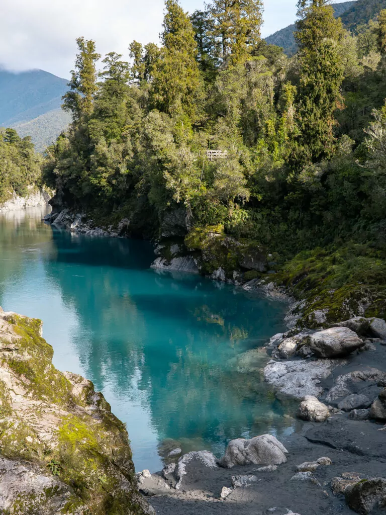
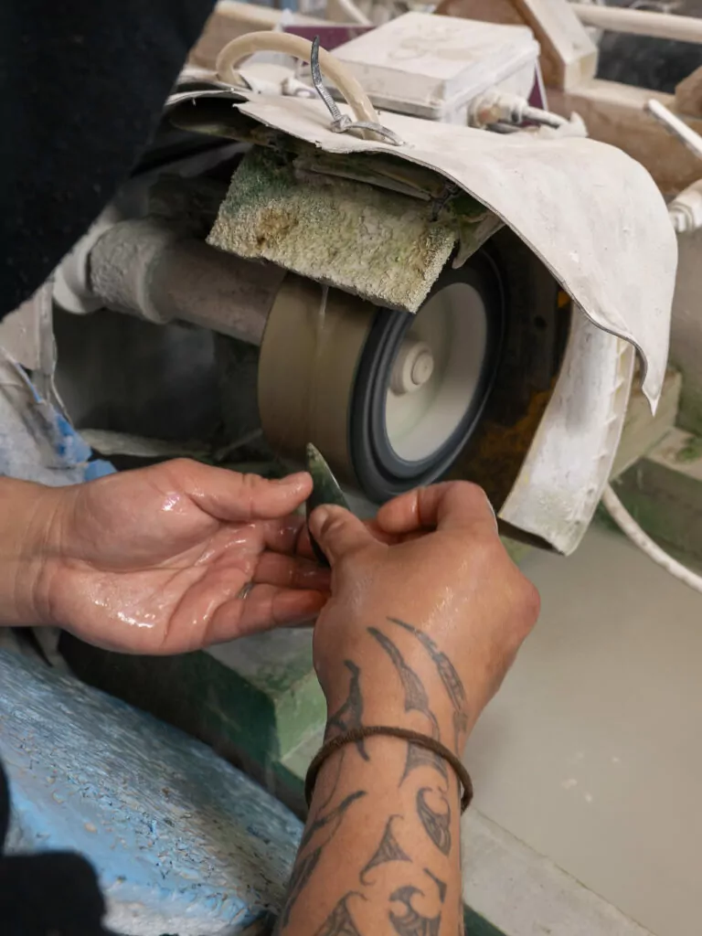
11. Hokitika
Location: West Coast, 1h 50m north of Franz Josef Glacier or 3h 20m from Christchurch over Arthur’s Pass
Hokitika might look like a sleepy seaside stop at first glance, but stick around for more than just a fuel top up and you’ll soon see why it’s known as New Zealand’s ‘Coolest Little Town’.
What Hokitika is known for
- Being the pounamu (greenstone) capital of Aotearoa, with workshops where you can carve your own under the guidance of master carvers
- My personal top pick for the best short walk in New Zealand, the Hokitika Gorge
- Fiery West Coast sunsets
- Free glowworms in a dell a short walk from town
- The legendary Hokitika Sandwich Co.
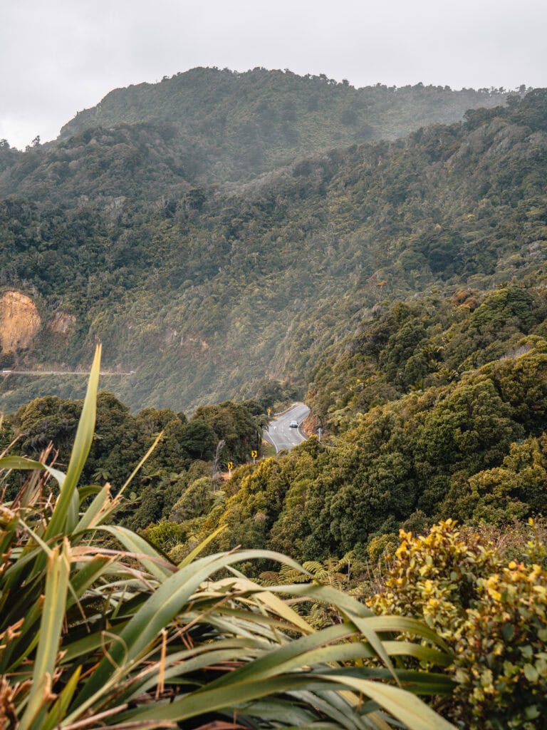
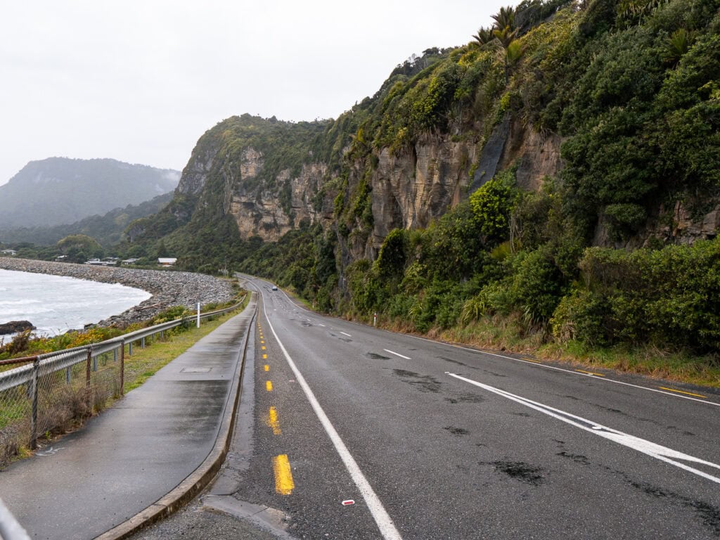
12. Upper West Coast (Greymouth to Karamea)
Location: Hokitika to Greymouth is about 30 mins and then it’s about 3h to Karamea
The northern stretch of the West Coast is a rugged mix of coal mining outposts, cave systems, sea stacks and intrepid bush walks.
Most travellers turn inland after the world-famous Great Coast Road from Greymouth to Westport, but keep driving north and you’ll find limestone caves, beachfront campgrounds and the start (or end) of the longest Great Walk, the 78km Heaphy Track.
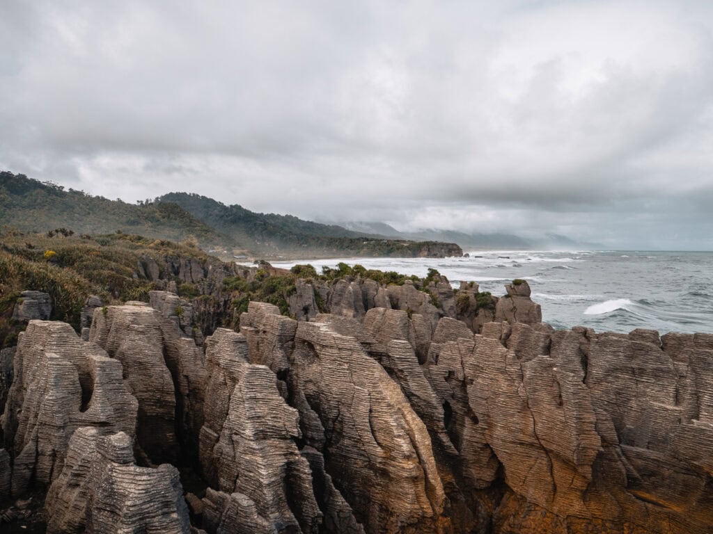
What the upper West Coast is known for
- Punakaiki’s Pancake Rocks, layered limestone stacks with blowholes that erupt at high tide
- A coastal road regularly ranked amongst the world’s best drives
- Quirky local experiences you won’t find anywhere else in the South Island, like glowworm rafting, knife-making and Clydesdale wagon rides
- Beachfront campgrounds and day hikes well away from the typical tourist trail
13. Lewis Pass
Location: Connecting North Canterbury with the West Coast via SH7
The northernmost crossing of the Southern Alps, connecting the upper West Coast with Hanmer Springs and the wider Hurunui district, the Lewis Pass is a quieter but still stunning alternative to Arthur’s Pass.
What Lewis Pass is known for
- Geothermal hot pools, glamping pods and boutique suites in a secluded valley at Maruia Hot Springs
- Easy alpine walks right at the top of the pass
- Generally fewer campervans and tour buses than Arthur’s Pass further south
- Reefton on the western side of the pass, a tiny heritage town that’s in its revitalisation era! Stop for a gin tasting and window shopping at the antique stores.
Very Top of the South Island: Beaches, vineyards & sunshine
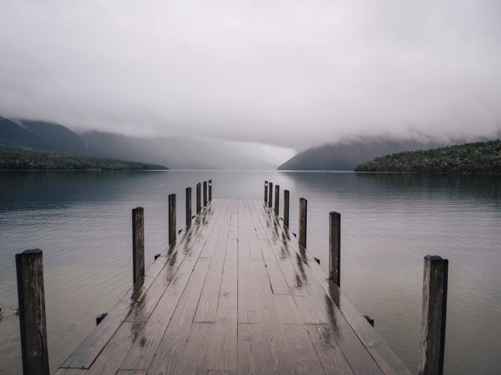
14. Nelson Lakes National Park
Location: The start of the Southern Alps in the middle (width-wise) of the island. St Arnaud is about 1h 15m south of Nelson, 1h 30m southwest of Blenheim, 3h northeast of Greymouth.
Much of the South Island will ‘wow’ you with scale and drama, but Nelson Lakes wins you over with stillness and total tranquillity instead.
Lake Rotoiti’s famous reflection jetty is the region’s quick postcard shot for road trippers heading to the West Coast from Nelson-Tasman or Marlborough, but intrepid hikers will find plenty of backcountry adventures to choose from for longer walks and multi-day tramps.
St Arnaud is the gateway to the national park, but Murchison (45 mins west) has more accommodation options.
What Nelson Lakes is known for
- Lake Rotoiti’s jetty for its reflections on a still day (and the friendly eels that live underneath it)
- Some of New Zealand’s best multi-day backcountry hiking trails for experienced walkers
- Cheap and casual accommodation if you just need somewhere affordable to rest between regions
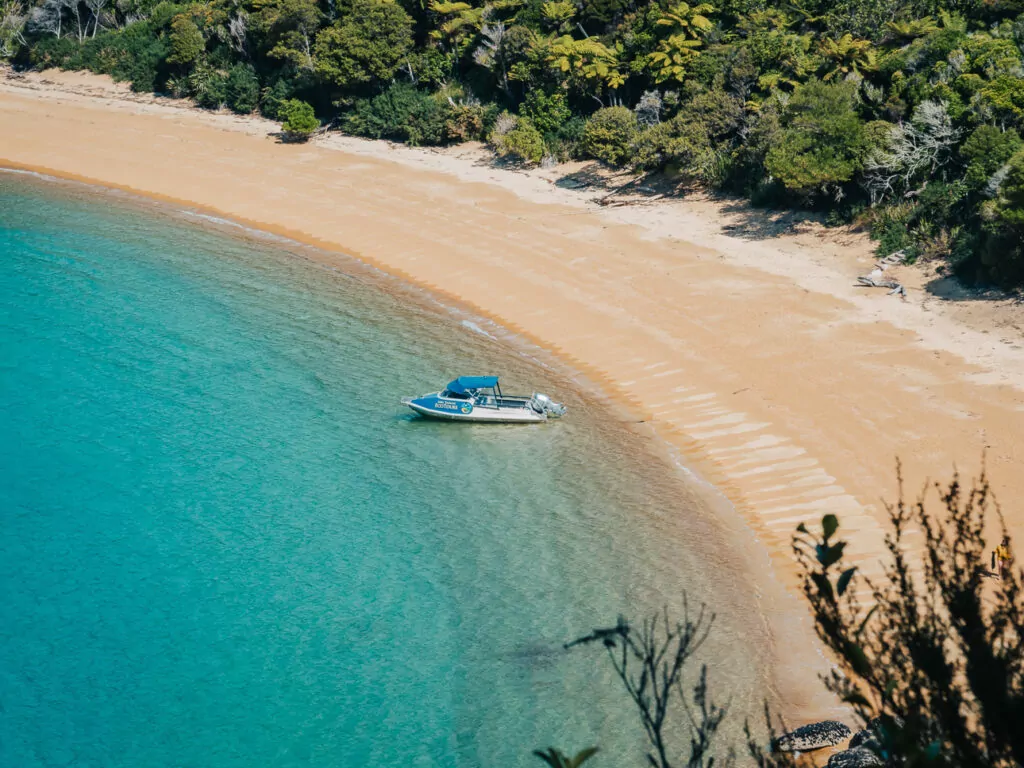
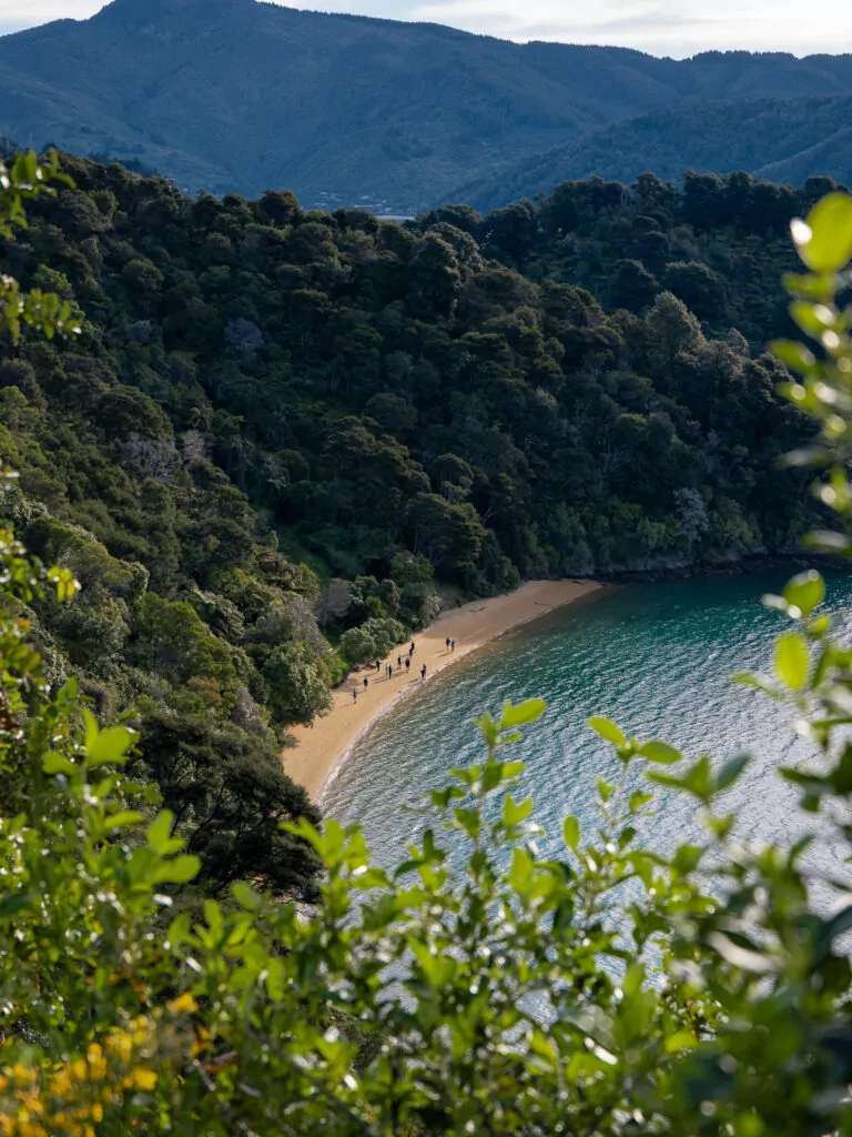
15. Abel Tasman National Park
Location: In the northwest bit of the South Island, accessed via Motueka (35 min from Nelson), Kaiteriteri (50 min) or Marahau (1h)
This tropical-looking slice of the South Island’s northern coastline feels like a glitch in the matrix.
Most beaches down south are raw, wild and exposed to the elements (better for sunset picnics or surf sessions than sunbathing or swimming) but New Zealand’s smallest national park honestly looks a bit… and it pains me to say it, but… Australian? Like Northern Queensland, but without the murderous animals 🙃
There are no roads within the park boundaries so you have to explore by boat, kayak or hike to reach the best bits. Motueka is the closest town, Kaiteriteri is the little beachfront village with family-friendly beaches and where day cruises start, and Mārahau is where the track begins.
What Abel Tasman is known for
- The Abel Tasman Coast Track, the most flexible Great Walk in the country thanks to water taxis and organised tours that let daytrippers reach the remote sections without having to camp along the way
- Split Apple Rock, a granite boulder cracked almost perfectly in half sitting just offshore
- Sunny conditions year-round that make it ideal for kayaking and boat trips
➡️ Read more: My full guide on the best things to do in Abel Tasman covers all the best things to see and do in this slice of paradise.
16. Golden Bay & Tākaka
Location: The northwest corner of the South Island, over the Tākaka Hill from Motueka/Kaiteriteri
Abel Tasman might feel like a glitch in the South Island matrix, but crossing the Tākaka Hill feels like travelling back in time, where cash is preferred over card, shoes are optional, and the cinema still has an intermission.
Alternative lifestyles are mainstream in the tiny coastal settlements that line the bay, attracting a colourful mix of characters from creatives and escapists to naturists and diehard off-gridders. Everyone with an open mind is welcome.
What Golden Bay is known for
- Hippie vibes, plant-based cafes, crystal shops and eco-conscious living
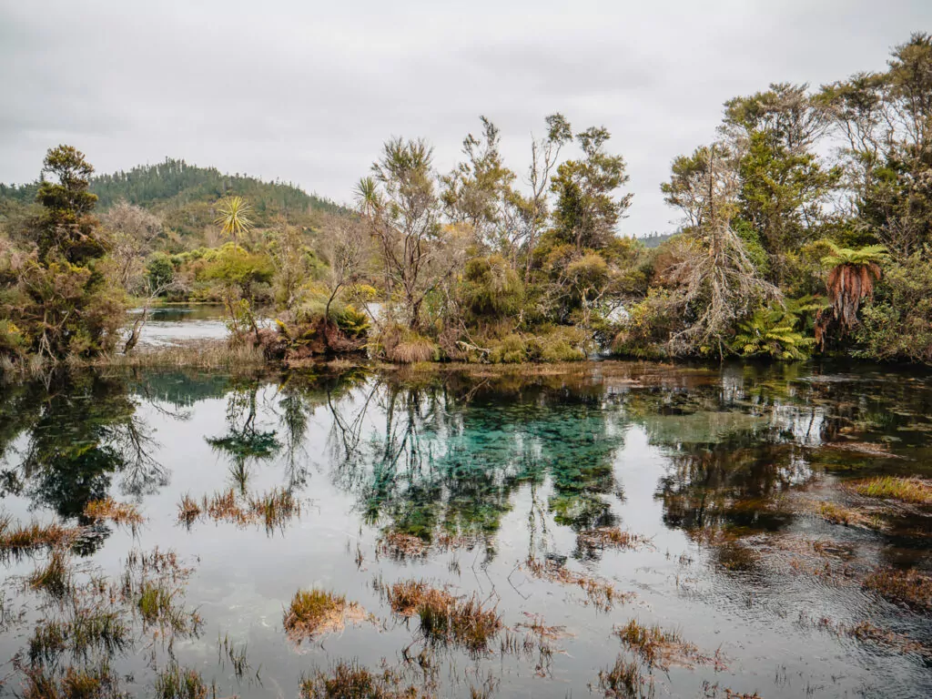
- Some of the clearest freshwater on the planet at Te Waikoropupū Springs
- Farewell Spit, a dramatic sandbar stretching 34km into the sea
- Wharariki Beach, a remote coastal spot that became world-famous overnight as a Windows desktop background
17. Nelson
Location: At the top of the South Island, between the Marlborough Sounds and Abel Tasman National Park
Often battling it out with Blenheim for the sunniest place in New Zealand, the city of Nelson is a creative hub of local artisans, craft brewers, small-batch food producers and solar-powered outdoor adventurers wanting to be close to hikes, bike trails and beaches.
While it’s probably best recognised by international visitors as a transit hub between the labyrinthine Marlborough Sounds and the golden sands of Abel Tasman, Kiwis consider it one of the most liveable places in New Zealand thanks to its climate, easy access to three national parks and relaxed pace of life.
What Nelson is known for
- Reliable sunshine year-round and mild winter temps
- The Great Taste cycling trail that connects vineyards, breweries and coastal viewpoints (you can rent bikes from Cycle Nelson for day rides)
- Saturday markets packed with stalls selling locally-made treats
- Loads of galleries and giftshops to grab souvenirs or artwork to take home
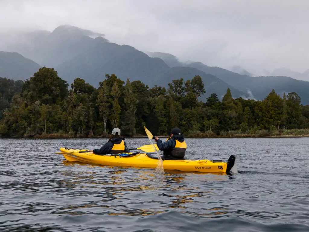
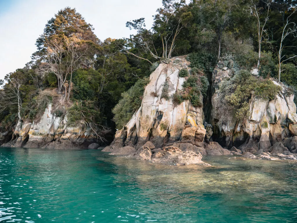
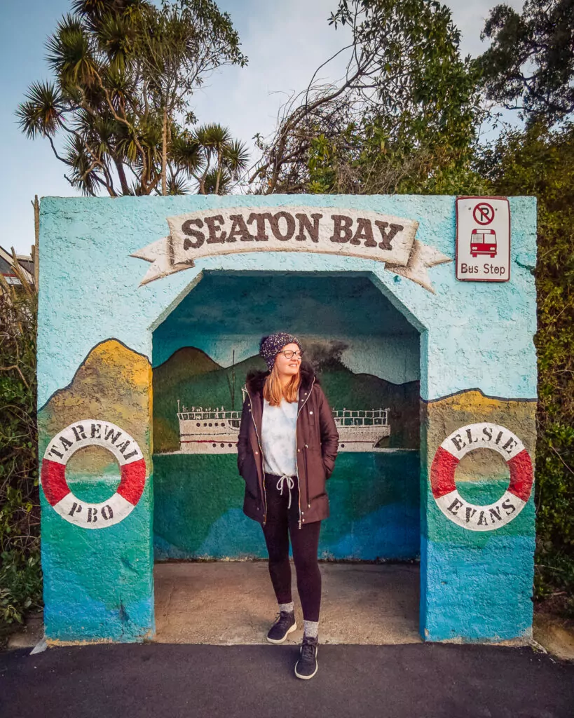
18. Marlborough Sounds
Location: The northeast corner of the South Island
If you’re arriving by ferry from Wellington then these will be the first landscapes you see, and what a way to kick off a trip!
The Marlborough Sounds are home to a collection of drowned valleys, hidden bays and island sanctuaries, making this one of the best places in the South Island to truly disconnect.
You’ll find panoramic lookouts and pristine coves along the scenic Queen Charlotte Drive from Picton to Havelock, but the best bits of the Marlborough Sounds are only accessible by boat, kayak, hiking, biking or a scenic flight.
What the Marlborough Sounds are known for
- Water-based exploring by kayak, cruise or the iconic Pelorus Mail Boat
- A maze of waterways and hidden bays so intricate and extensive that you can only understand the scale when you see them from a scenic flight
- Secluded lodges only accessible by boat, perfect for a proper digital detox
- Family-friendly beaches, swimming holes and coastal walks just off the main road
- Perfectly calm conditions making it the best place for wildlife cruises or dolphin swimming if you’re prone to seasickness
➡️ Read more: For a deeper dive into logistics, exact tours I recommend and where to stay, check out my guide to the best things to do in Blenheim & the Marlborough Sounds.

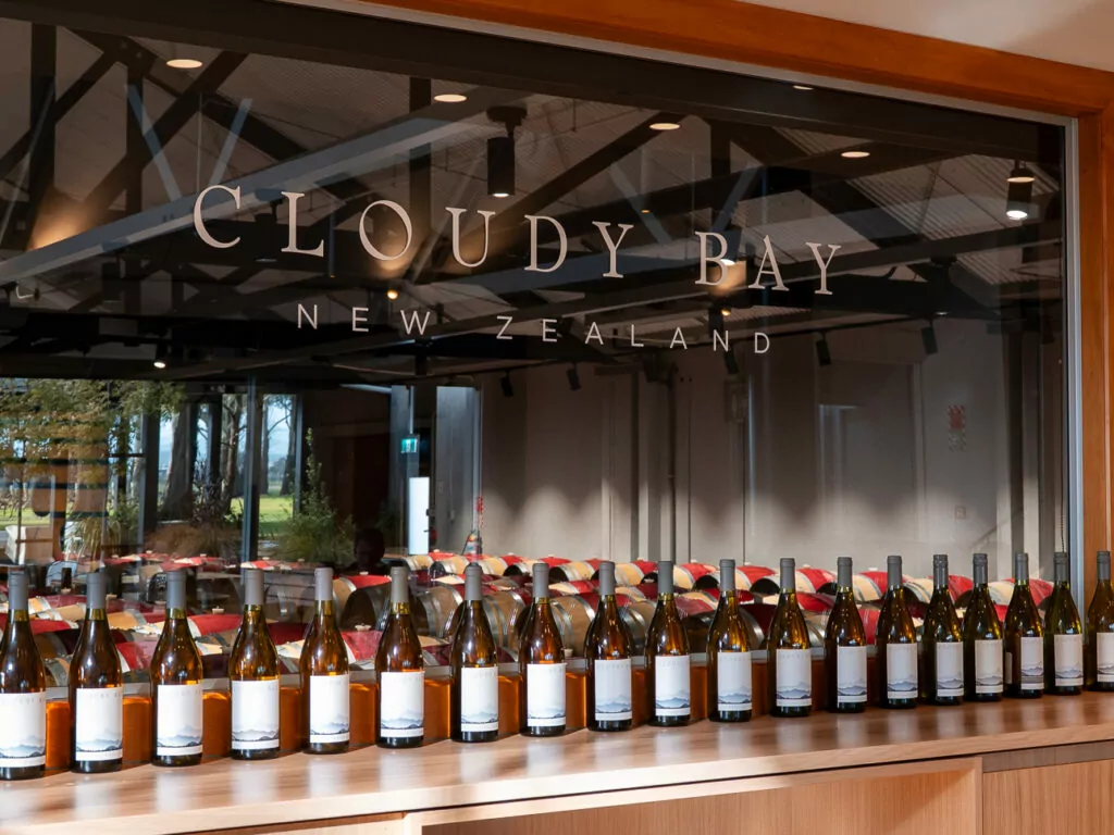
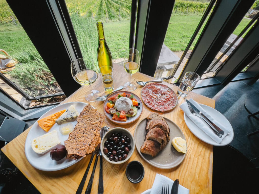
19. Blenheim & Marlborough wine region
Location: Marlborough region in the northeast corner, 25-30 mins south of Picton
Calling all culinary connoisseurs and keen oenophiles! Blenheim and its surrounding wine region are a must-do pilgrimage for anyone who enjoys a fruity Sauvignon Blanc, a good grazing board or paddock-to-plate dining.
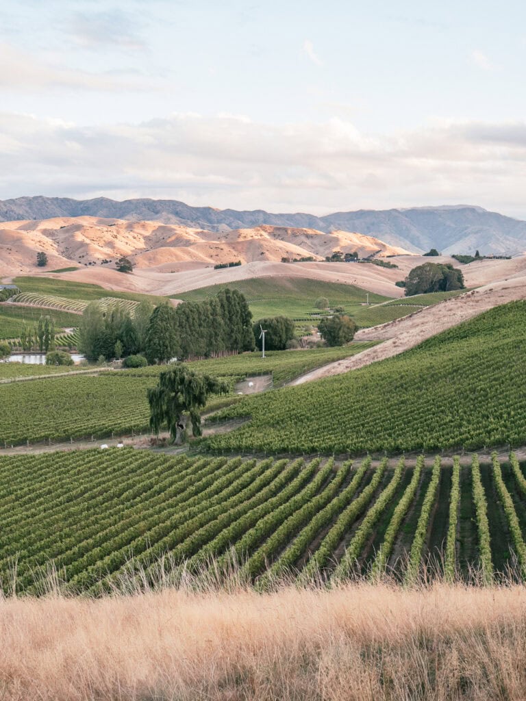
What Marlborough wine region is known for
- Being the powerhouse of Kiwi viticulture, producing more than 75% of New Zealand wine, with over 150 wineries and 30 cellar doors you can visit for tastings
- A growing gastronomic scene with a massive focus on seasonal and locally-sourced ingredients and (of course) wine matching
- Year-round sunshine, beautiful gardens and easy bike paths if you’re a non-drinker
➡️ Read more: My guide to Blenheim & the Marlborough Sounds has all the details on wineries, tours and where to stay.
The Alpine Pacific: Dolphins, wineries & thermal pools
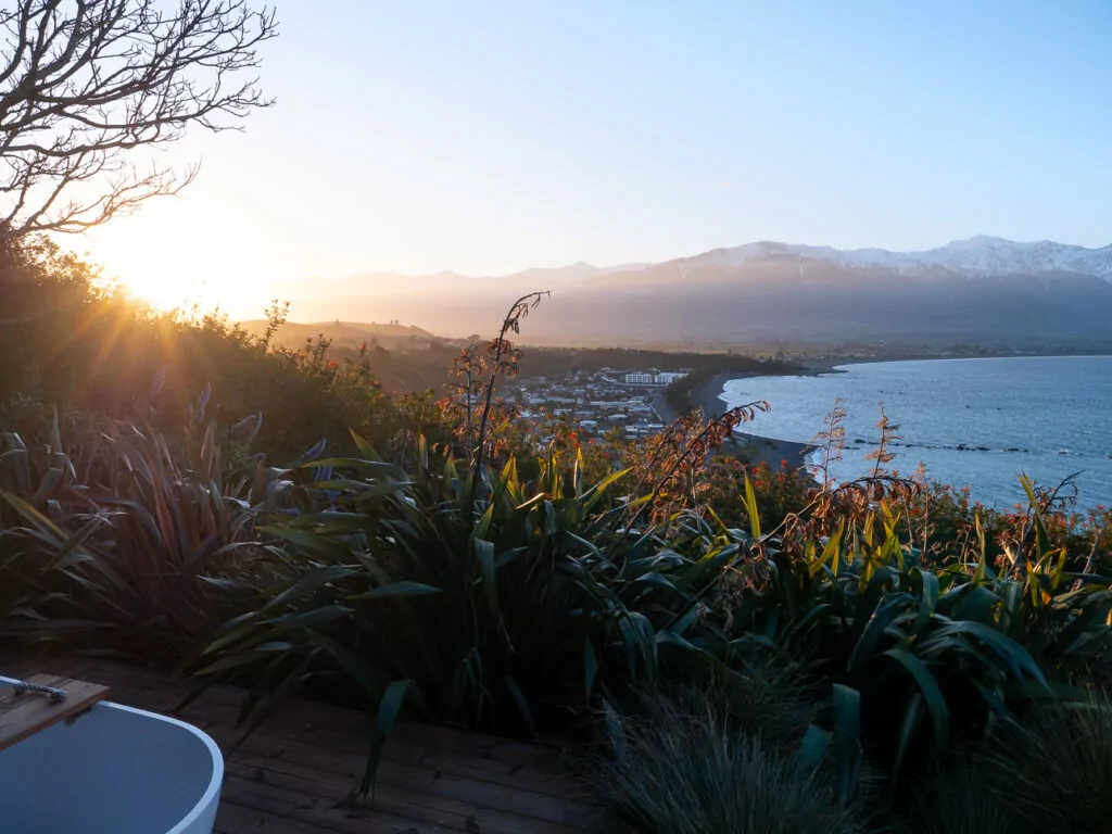
20. Kaikōura
Location: North Canterbury, on the east coast (2h 30m north of Christchurch and 1h 40m south of Blenheim)
Blessed both geographically and ecologically, Kaikōura is one of the best places in the South Island for marine wildlife, landscape photography and fresh seafood straight from the source.
It sits right where the Seaward Kaikōura Range crashes into the sea, while just offshore there’s a gigantic underwater canyon that stirs up microscopic nutrients and acts as a magnet for all kinds of ocean dwellers and the seabirds that follow them around.
And if you prefer to stick to dry land, the rugged coastline has walking tracks, lookouts and plenty of adventures to keep you busy.
What Kaikōura is known for
- Abundant marine wildlife and ethical encounters, including year-round whale watching, albatross cruises and seal colonies where you can watch young pups playing in the rockpools
- Swimming with wild dusky dolphins, genuinely one of the most incredible things to do in New Zealand
- Mountains that crash right into the ocean in a spectacularly photogenic way
- Fresh crayfish from roadside caravans
➡️ Read more: For a deep dive into the best tours, food spots and exact photo locations, read my full guide on the best things to do in Kaikōura.
21. Waipara Valley & Hurunui Heartland
Location: North Canterbury, about 45 mins north of Christchurch and 1h 30m south of Kaikōura
Most people blast through here while mindlessly driving SH1 between Christchurch and Kaikōura, completely unaware that this stretch of the highway is flanked by organic wineries, olive groves and family farms serving up some of the country’s best food and wine experiences.
A gastronomic getaway in the Waipara Valley pairs perfectly with a side trip to the Hurunui coast, where you can marvel at the eroded pillars of the Cathedral Cliffs and stretch your legs with a walk along Gore Bay.
What Waipara Valley & Hurunui are known for
- Under-the-radar wineries and restaurants that most tourists drive straight past
- Off-grid stays with outdoor baths, mountain views, no light pollution and no phone signal
- Striking coastal scenery that’s well off the beaten track
➡️ Read more: For a full Hurunui itinerary including where to eat and stay, check out my Christchurch to Hanmer Springs road trip guide.
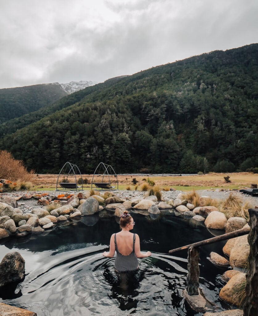
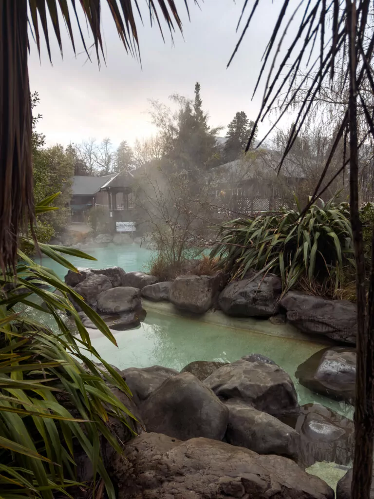
22. Hanmer Springs
Location: North Canterbury, inland from SH1, about 1h 45m from Christchurch or Kaikōura
If you plan on conquering some Great Walks or if you’re roughing it in a high-top Hiace with a thin mattress and barely any space to stand, Hanmer Springs is one of the best South Island destinations for a wellness escape. Your body will thank you.
And for the active relaxers out there, skip the hot pools for forest hikes, bike rides and thrill activities that’ll get your heart racing. Or better yet, go for a soak once you get back to town!
What Hanmer Springs is known for
- Being New Zealand’s premier alpine spa village and a popular local getaway from Christchurch, especially during weekends and school holidays
- Hanmer Springs Thermal Pools & Spa, a huge complex with hydroslides, a lazy river, mineral hot pools and a lush beauty spa for private treatments
- Adrenaline rushes like bungy jumping and jetboating for cheaper than you’ll find in Queenstown
- Easy access to forest walks, mountain biking and ski slopes in winter
➡️ Read more: For more Hanmer Springs suggestions including the best experiences and where to stay, check out my Christchurch to Hanmer Springs road trip guide.

- Hanmer Springs
Christchurch & beyond
23. Christchurch
Location: Canterbury region, about 1/3 of the way down the east coast
Christchurch (Ōtautahi) is the South Island’s largest city and busiest airport, so it’s often the first or last stop on a South Island itinerary.
Since the 2010-2011 earthquakes it’s undergone a total transformation, practically being rebuilt with a mix of heritage restoration, innovative urban design and dynamic foodie precincts that make the city centre a world-class destination.
There are also leafy parks, impeccably manicured gardens, a river you can float down on a punting tour and easy access to beaches and the stunning Banks Peninsula (more on that below).

What Christchurch is known for
- Being a logical start and/or end point for South Island road trips thanks to its international airport and large rental car fleets
- Street art, modern architecture and heritage buildings existing side by side
- A food scene that’s absolutely taken off in recent years, centred around Riverside Market and The Terrace
- A resilient and spirited community who have banded together after unimaginable hardships in recent history
24. Akaroa & Banks Peninsula
Location: Southeast of Christchurch, 1h 25m to Akaroa
Just behind Christchurch sits the Banks Peninsula, a volcanic crater (two actually) with French heritage, rare dolphins, wilderness trails and super scenic drives. What a mix!

What the Banks Peninsula is known for
- The main village of Akaroa, a quaint French settlement with authentic croissants and ‘rues‘ instead of roads
- One of the world’s smallest and rarest dolphins, Hector’s dolphins, that live in Akaroa Harbour. You can book a tour to swim with them in summer.
- Unique stays dotted around the peninsula, including an all-glass PurePod above Port Levy, glamping cabins with woodfired hot tubs, and you can even sleep in a custom-built grain silo!
- Volcanic coastal scenery, best viewed from the winding Summit Road
- Hiking trails loved by locals but that fly under the tourist radar
25. Arthur’s Pass
Location: Connecting the Canterbury & West Coast regions via SH73
The name ‘Arthur’s Pass’ belongs to three things: the highest road crossing over the Southern Alps, the national park it runs through, and the tiny village that serves as the starting point for plenty of backcountry adventures.
The alpine pass links the West Coast with Canterbury in the east via snaking roads and massive viaducts, and the TranzAlpine scenic train services the route between Greymouth and Christchurch daily.
What Arthur’s Pass is known for
- Being the most dramatic of the Southern Alps crossings
- Cheeky kea (alpine parrots) hanging out at carparks hoping to find some well-meaning tourists who didn’t see the huge ‘DO NOT FEED THE KEA’ signs (seriously though, don’t feed them)
- Castle Hill / Kura Tāwhiti, a limestone landscape with giant boulders, cultural significance and silver screen fame
- Plenty of hikes that branch from the alpine village into the national park, from short walks to multi-day backcountry tramps
➡️ Read more: Can’t decide between the West Coast or Mackenzie region? My Queenstown to Christchurch road trip itinerary breaks down the best bits of both routes to help you choose.
Lindis, Ōmarama & the Waitaki Valley
26. Lindis Pass & Ōmarama
Location: SH8, connecting the regions of Canterbury and Otago
An underdog contender for the most photogenic segment of a Queenstown to Christchurch road trip, the Lindis Pass connects the Central Otago adventure hubs and wine regions with the glacial lakes and high country farms of the Mackenzie Basin.
A bit further north on SH8 is Ōmarama, a blink-and-you’ll-miss-it service town with a couple of side quests if you’ve got time to stop.
What the Lindis Pass & Ōmarama are known for
- The highest point of the South Island’s state highway network, 971m, with a carpark for quick photo stops and a short walk to a panoramic lookout
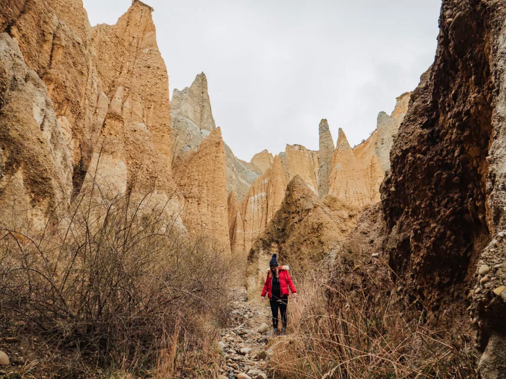
- Ōmarama’s otherworldly Clay Cliffs, a bunch of eroded pinnacles hidden down a gravel road
- Having some of the cheapest fuel in the South Island, Tasman Fuels right at the Ōmarama junction always has one of the lowest prices on the Gaspy app map!
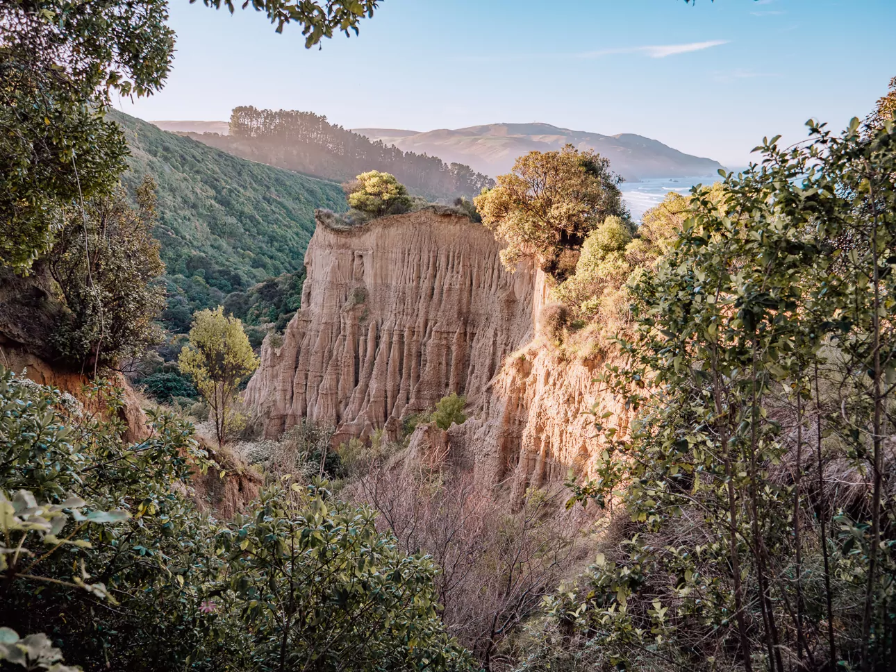
27. Ōamaru & Waitaki Valley
Location: The border of Canterbury and Otago
Most travellers autopilot through Ōmarama, fuelling up at the cheap gas station before racing off towards Queenstown or Tekapo, but if you turn east you’ll discover some absolute gems that I promise will end up in your highlights reel.
SH83 through the Waitaki Valley isn’t as cinematic as the lake-edge drives and alpine passes further inland, but tucked into the hills are the Elephant Rocks, ancient Māori cave art and some of the South Island’s best glamping spots. And that’s just the first part!
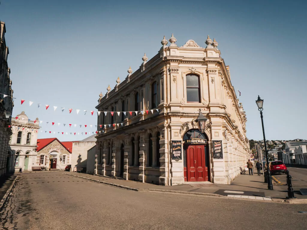
At the end of the road you’ll reach the North Otago coast and small town of Ōamaru, a weird and wonderful place that blends Victorian architecture, Steampunk culture, penguin colonies and superb farm-to-table cuisine.
What this area is known for
- Ōamaru for being the unofficial steampunk capital of the world, complete with an interactive steampunk museum
- Blue penguins waddling ashore at dusk with grandstands for easy and responsible viewing
- Streets lined with Victorian facades that’ll make you forget what century you’re in
- Excellent value for money compared to more touristy South Island spots
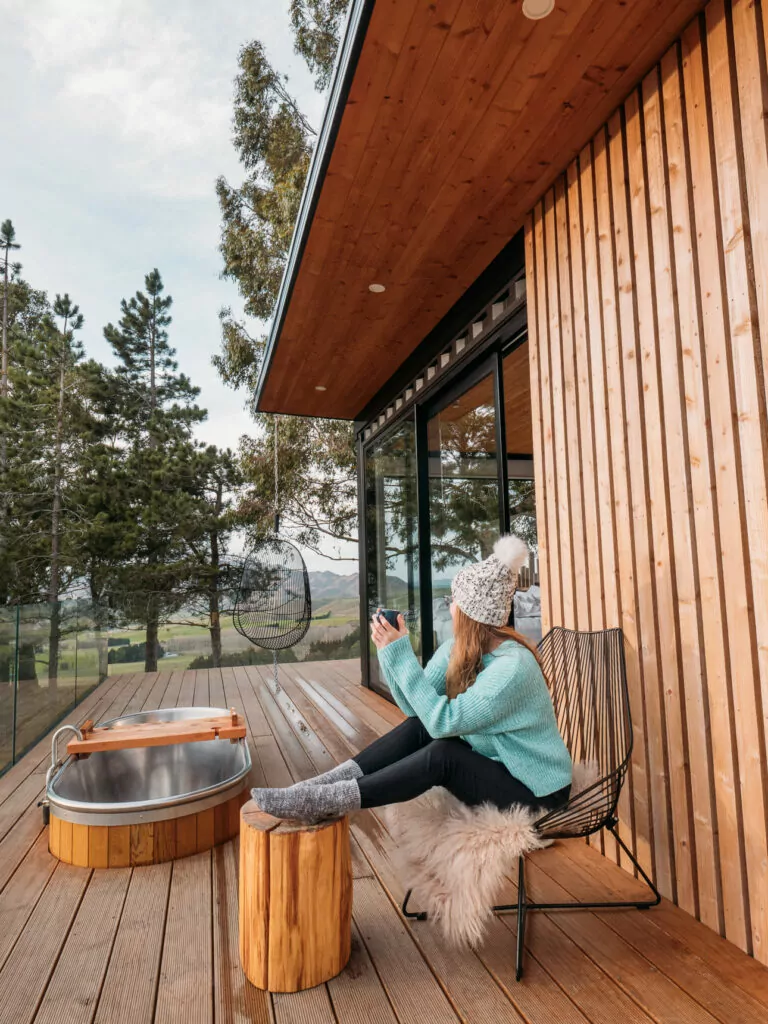
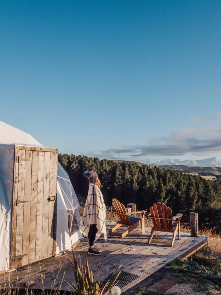
- Hidden glamping spots in the Waitaki Valley
- Nest Treehouse
- Valley Views
The Deep South: Wildlife galore
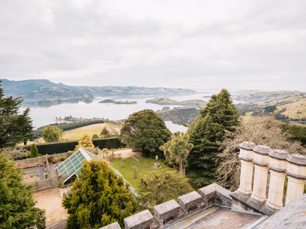
28. Dunedin & Otago Peninsula
Location: Otago coast, 4h 30m south of Christchurch and 3h 30m east of Queenstown
Dunedin (Ōtepoti) holds a unique mix of titles: it has the world’s steepest street, NZ’s only castle, and it’s the couch burning capital of the country. Sorry, make that the former capital.
This southern hub is a university city at heart, but beyond the rowdy suburbs there’s Gothic architecture to see, rich settler history to discover and a youthful energy that’s a welcome perk of 1 in 5 residents being students.
The real drawcard for travellers though is the neighbouring Otago Peninsula, a wild stretch of coastline that gives Kaikōura a run for its money in terms of animal encounters.
What Dunedin & the Otago Peninsula are known for
- The only mainland albatross breeding colony in the world
- Yellow-eyed penguins, blue penguins, NZ fur seals and sea lions that can be spotted in the waves and sand dunes of the Otago Peninsula
- The kind of youthful buzz you only find in student cities
- New Zealand’s only castle, Larnach Castle, where you can walk through the grand rooms, enjoy a high tea or even spend the night
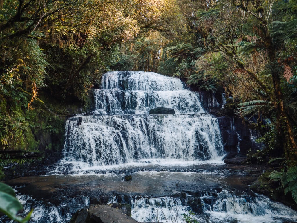
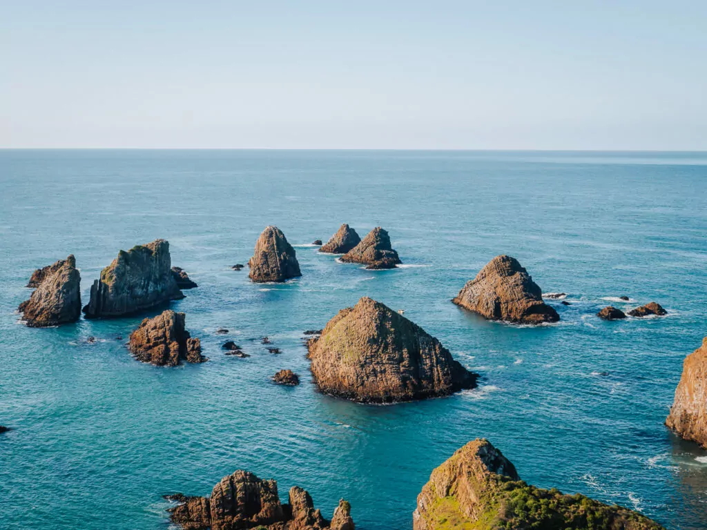
29. The Catlins
Location: Bottom left corner of the island, Otago & Southland regions
This southeast slice of the South Island is criminally underrated, unknown by the vast majority of international visitors and even many Kiwis!
But for outdoor adventurers hoping to steer clear of mass tourism, the Catlins’ walking trails, waterfalls and wildlife encounters are your best bet.
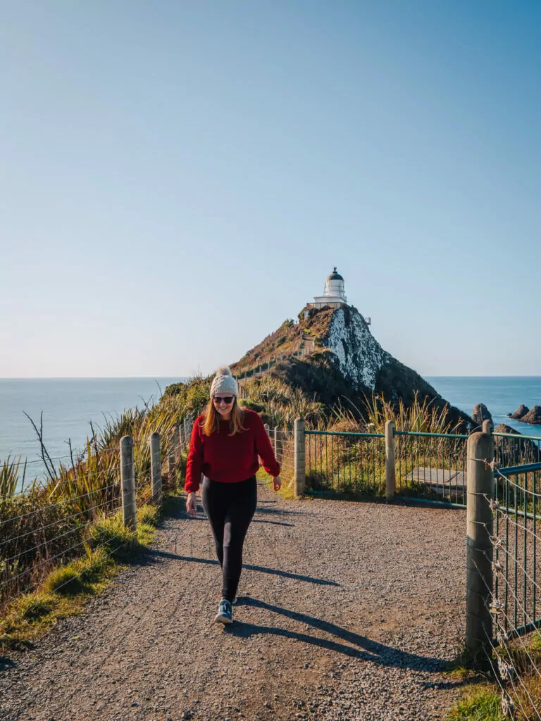
What the Catlins are known for
- Wild, windswept coastlines that have been battered by the elements for millennia
- Nugget Point Lighthouse, perched on a headland above a cluster of rocky islands, best experienced at sunrise
- The Jurassic-era Petrified Forest of Curio Bay
- Waterfalls hidden in native forest and sea caves only accessible at low tide
- Sea lions, penguins and dolphins going about their business unbothered
➡️ Read more: For a full rundown of this underrated region, check out my guide on the best things to do in the Catlins.
30. Stewart Island / Rakiura & Bluff
Location: Southland, Bluff is 2h 45m from Queenstown and Stewart Island is a 1h ferry from there or 20 min flight from Invercargill
Technically not the South Island but close enough (it’s an hour away by boat), Stewart Island / Rakiura is one of the best places for seeing wild kiwi, birdwatching, fishing, tramping, astrophotography, and spotting the elusive Aurora Australis (Southern Lights).
Bluff on the mainland is the gateway to Stewart Island by ferry and world-famous for its plump oysters, ideal for a lunch break if you’re there in season (March to August).
What Stewart Island / Rakiura is known for
- The best chance in New Zealand to see wild kiwi in their natural habitat
- Minimal light pollution for maximum stargazing
- Ulva Island, a predator-free bird sanctuary a short water taxi from the main town
- Potential sightings of the aurora australis (Southern Lights) during the darker months

FAQs about the best places to visit in the South Island
What is the most beautiful part of the South Island?
There’s no single most beautiful part of the South Island, the scenery varies by region and you’ll find stunning landscapes all over the island. Some of the most dramatic scenery is found in Queenstown, Milford Sound, Aoraki / Mount Cook, Lake Tekapo, the West Coast glaciers, Abel Tasman National Park, the Marlborough Sounds and Kaikōura.
What are the most underrated places in the South Island?
The best off-the-beaten-track destinations are The Catlins for rugged coastal beauty, Doubtful Sound for a quieter and more remote alternative to Milford, Waipara Valley for food and wine, and Oamaru and Hokitika for quirky character.
What are the most scenic drives in the South Island?
The South Island has plenty of spectacular drives, including the Milford Road in Fiordland, the Haast Pass between Wanaka and the West Coast, the Lindis Pass connecting Otago to the Mackenzie Basin, the road from Queenstown to Glenorchy, Great Coast Road in the upper West Coast and Arthur’s Pass across the Southern Alps.
Where are the best places for wildlife in the South Island?
The best South Island spots for wildlife encounters are Kaikōura for whales, dolphins and seals, the Otago Peninsula near Dunedin for albatross and penguins, the Catlins for sea lions, Stewart Island / Rakiura for wild kiwi spotting and Fiordland for the rare tawaki (Fiordland crested penguin).
Where can I find the best adventure activities in the South Island?
Queenstown is the global adventure capital, with bungy jumping, skydiving, jetboating, paragliding and lots more on offer. The West Coast is famous for heli-hikes in Glacier Country but also has ziplining, cave rafting and quad biking, and Hanmer Springs is another adventure hub with more affordable prices for bungy jumps, jetboat trips and 4WD tours.
Should I visit the North Island or South Island?
The South Island is best for diverse landscapes, from glacial lakes and mountains to wild coastlines, ideal for hiking, road trips and bucket list activities. The North Island has gentler scenery but wins on Māori culture, swimmable beaches, geothermal activity and affordability.
Is Queenstown or Wānaka better?
Queenstown is the high-energy lakefront adrenaline hub with better nightlife, a huge range of accommodation, more retail stores and loads of bucket list experiences on its doorstep. Wānaka offers similar alpine-and-lake scenery but with a much more relaxed and authentically Kiwi atmosphere. Choose Queenstown for buzz and action, go to Wānaka when you want to escape the tour buses.
Is Milford Sound or Doubtful Sound better?
Milford Sound is more striking with taller peaks and sheer cliffs, but it’s accessible by road and gets very busy with daytrippers. Doubtful Sound is larger, greener and more remote, less dramatic but still magical, and it’s only accessible by tour so it’s way quieter.
So… where to next?
If you’ve made it this far, congratulations! You’ve officially scrolled through the entire South Island highlights reel.
I’m going to take a wild guess and say that your bucket list is probably three times longer than it was when you started reading. I’m sorry about that, but alsoooo you’re welcome 🙃 This island is just unreal, you deserve to see as much of it as possible.
The hardest part now isn’t finding places to go, it’s deciding what spots take priority and which bits you’ll have to leave out for next time. It would be impossible (or at least unenjoyable) to see all of the best places in the South Island on any trip shorter than a couple of months, and even that would be at a quickfire pace.
Instead of trying to cram too many of these into a whirlwind loop, consider picking a few geographical regions to explore in depth. It’s far better to properly experience the wild West Coast, soak up the Alpine Pacific scenery or immerse yourself in Fiordland than to see the whole island through a campervan window because you’re driving four hours every other day for two weeks. Quality over quantity!
Ready to turn your South Island wanderlist into a plan? Now that you know where to go, it’s time to piece your wishlist all together into the perfect road trip route.
- Need a starter route to get inspired? Head over to my ultimate South Island road trip itinerary to see how to piece every single one of these spots together on a seamless road trip.
- Need logistical help? Check out my South Island travel guide for everything you need to know before you book, from the best time to visit to budgeting tips and how to get around.
- Need a lie down? Fair enough, so do I! Bookmark this page, close the tab and come back when you’re ready to lock in a plan, or send it to your travel buddy and get them to do the work.
Safe travels my friends, see you on the road 🚐
MY GO-TO TRAVEL PLANNING RESOURCES
Flights ✈️ I use Skyscanner to find the best flights for my trip and then I’ll always book direct with the airline to protect myself from having to deal with dodgy third parties if anything goes wrong.
Trains 🚂 If I’m travelling through Europe, I try to travel by train wherever possible! For an extended trip (2+ weeks) I’ll calculate if a Eurail Pass is worth it, or I’ll book point-to-point tickets through RailEurope or the local train operator.
Accommodation 🛎️ I book almost all of my accommodation through booking.com, they have a user-friendly website + app and many of their options are free cancellation, easily cancelled with a simple click of a button.
Activities 🗽I use GetYourGuide, Klook and Viator to look for activities in the places I visit, or I just Google ‘things to do in [city]’! P.S. If you book anything on Klook you can use the promocode FINDINGALEXXKLOOK to get 10% off
Travel cards 💳 I’m a Wise gal through and through, they’ve been my chosen travel card for more than five years now. You can easily top up your card from your bank account or through Apple Pay, convert your money to local currency, and spend money with minimal fees and the best exchange rates around.
Travel insurance 🩺 I use Cover-More NZ travel insurance for my own trips, I have a comprehensive policy and I’ve only had good experiences with them. Cover-More also has an Australian company, but if you’re from elsewhere then two popular insurance options for global travellers are SafetyWing (cheaper policy, lower coverage) and World Nomads (more expensive but significantly better coverage).
Luggage 💼 I travel with Samsonite Cosmolite suitcases, one 75cm check in bag and a 55cm carry on bag, and I absolutely adore them and will never travel with anything else! They are SUPER lightweight (2.8kg and 1.9kg respectively) so I have much more space for my actual stuff.
Camera gear 📸 I use a iPhone 15 Pro Max for phone photos/videos, and my camera kit includes a Lumix S9 (incredible lightweight full-frame camera, a game changer for travel creators!) with a 20-60mm lens, a Lumix G9 with an 8-18mm and 12-60mm lens, a DJI Mini 3 Pro drone and a GoPro Hero 10. I do all my writing and editing on my ASUS Zenbook 14, it’s lightweight but powerful enough for photo editing and intense blogging sessions.